Arctic Regional Synopsis
Regional charts and associated synopsis write-up capture ice and environmental conditions throughout the Arctic which are based on the U.S. National Ice Center’s weekly analysis. Charts and synopses are updated weekly on Fridays. Note: Baltic Sea analysis is provided by the Finnish Meteorological Institute. The Canadian Archipelago (Canada East, Canada North, Canada West, and Hudson Bay) analysis is provided by the Canadian Ice Service.
Regional Quick Access
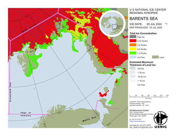
Barents Sea
In the Barents Sea multi year ice has drifted eastward north of Svalbard and Franz Josef Land, meanwhile sea ice is drifting southward along Novaya Zemlya and melting as it encounters warmer air and water temperatures. The ice edge in the northern and southern Barents has receded due to warm air temperatures. Ice in and around Franz Josef Land has seen significant melt with polynyas opening between the islands. Only a few fasted areas remain in the Barents Sea.
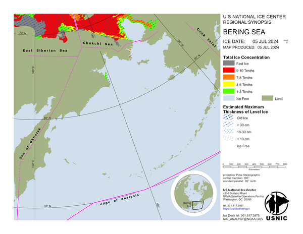
Bering Sea
Rotten first year ice remains in sheltered areas within the Gulf of Anadyr and the Bering Strait.
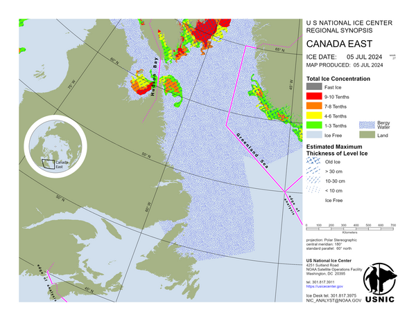
Canada East
Central and Southern Davis Strait contain mostly first-year ice with up to 2 tenths of old ice present in the ice-pack which is present in a large band extending down the coast of eastern Baffin Island. Frobisher Bay contains first-year ice with a trace of old ice along with areas of bergy water. Labrador Coast is bergy water.
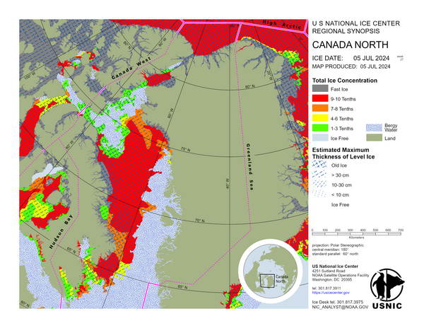
Canada North
The Eastern Arctic Ocean consists mainly of old ice with some first-year present within the main ice-pack and along Ellesmere and Axel Heiberg Islands. An ice-bridge consisting of old and first-year ice remains in place in northern Nares Strait. South of the ice-bridge, a zone of bergy water is present while the rest of the Strait contains a mixture of old and first-year mobile ice. The Archipelago is characterized by a mixture of old and first-year ice. The ice in this area has begun to rot with widespread surface flooding and several areas of bergy water present. The ice in Prince-Regent Inlet (PRI) and the Gulf of Boothia is mostly first-year with some old ice present in northern PRI. The ice in eastern Barrow Strait and Lancaster Sound is a mixture of old and first-year ice in open or very open drift conditions with its central area marked by a large tract of bergy water. Northwestern Baffin Bay contains old and first-year ice in open drift conditions with a large area of bergy water also present. A vast area of bergy water remains present south of this area, adjacent to eastern Devon Island and extending well into western Baffin Bay. The main pack in Baffin Bay and northern Davis Strait is predominantly first-year ice with small amounts of old ice present in all but its northern and easternmost sections. Coastal Greenland consists of fast first-year ice adjacent to the above-mentioned first-year icepack north of Upernavik. South of that point, the coast of Greenland is marked by a few remaining patches of first-year fast ice and bergy water offshore. Cumberland Sound contains a large zone of bergy water and a mixture of old and first-year ice in open drift conditions. Two large areas of bergy water are now present in Roes Welcome Sound and Foxe Basin’s northwestern section.
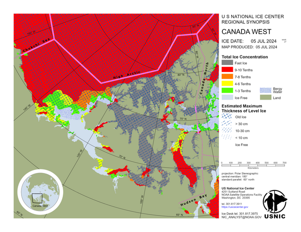
Canada West
The fast ice in the northwestern section of the Queen Elizabeth Islands, in Hazen Strait, Prince Gustaf Adolf Sea, Peary Channel and Sverdrup Channel, contains mostly old ice with some firstyear ice. The fast ice in Norwegian Bay and Belcher Channel contains mostly first-year ice with some old ice. The fast ice in Byam Martin Channel and Massey Sound contains a mix of old ice and first-year ice. North of Cornwallis Island, in the Wellington Channel, the fast ice contains firstyear ice. In the southern section of the Queen Elizabeth Islands, polynyas are developing, creating small areas of bergy water, mobile first-year ice, and old ice. The entrance to Parry Channel, in M’Clure Strait, contains bergy water with a small area of drifting first-year ice that contains a trace of old ice. The fast ice in Viscount Melville Sound contains firstyear ice with some old ice. To the east, in Barrow Strait, the fast ice contains exclusively first-year ice. The section of Barrow Strait that is north of Somerset Island contains mobile ice made up of first-year ice with a trace of old ice. M’Clintock Channel, Peel Sound, and Queen Maud Gulf contain fast first-year ice. A small area of very close pack mobile first-year ice remains present in Victoria Strait. Coronation Gulf has fast first-year ice in its eastern section and mobile first-year ice and areas of open water in the western section. Amundsen Gulf is mostly open water with small areas of very open drift. In Dolphin and Union Strait there is very close pack first-year ice. There is first-year fast ice along most of the length of the Yukon and Alaska coastline. Some areas of open water are developing in the fast ice, near shore. Offshore, in the Beaufort Sea, the ice is mostly first-year ice. Off the coast of the Northwest Territories there are areas of open water and first-year ice. North of 72°N, the Beaufort Sea consists of old and first-year ice in roughly equal proportion, except for the north central region which is mostly first year ice. South of 72N, the ice is mostly first-year with some old ice. There is a band of bergy water running along the southeastern Beaufort sea from the entrance of M’Clure Strait, along the west coast of Banks island, and stretching south west below 71N. The Arctic Ocean consists of old ice with some regions that include first-year ice along the northern coastlines of the QEI.
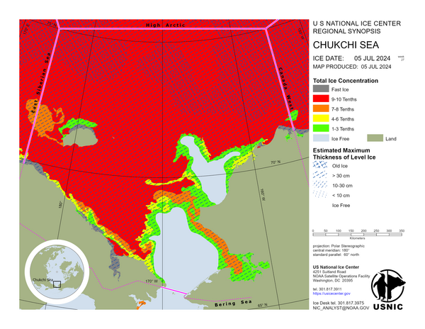
Chukchi Sea
Polynyas in the Bering Strait and off the coast of Alaska continue to widen as air temperatures warm.
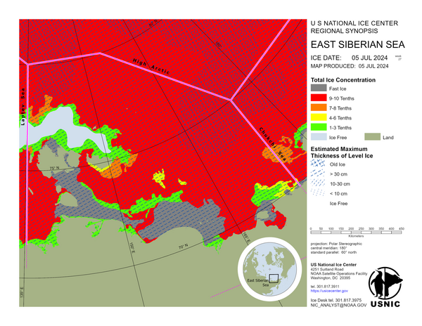
East Siberian Sea
Polynyas continue to widen along the coastline due to river runoff and around the new Siberian islands. First year ice is largely steady with minimal drift across the East Siberian Sea.
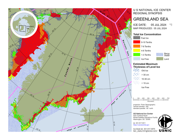
Greenland Sea
In the Greenland Sea, first year and multiyear sea ice has continued to degrade due to seasonal melt. Influences from the East Greenland and Irminger surface currents allow the pack to continue to drift southward toward and around Cape Farewell. Land-fasted ice in multiple protected inlets has begun to melt. A large polynya has formed to the north of Greenland. The ice edge has retreated toward the landmass approximately 50 nautical miles along the Denmark Strait over the past week.
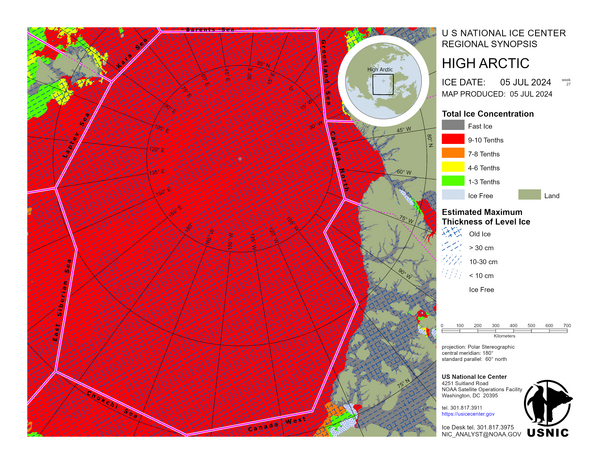
High Arctic
No synopsis write-up for the High Arctic as it remains consistent throughout this part of the year. A synopsis write-up will begin during summer months as ice retreats and becomes more dynamic in the region.
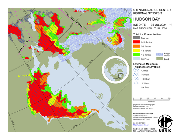
Hudson Bay
Foxe Basin contains first-year ice that is gradually ablating. Western Hudson Bay, western James Bay and southern Foxe Basin contain first-year ice. Eastern Hudson Bay consists mostly of ice free and central and eastern James Bay consist mostly of open water with some first-year ice present in very open drift conditions. Eastern Hudson Strait contains first-year ice in open drift while the western section of Hudson Strait is predominantly bergy water. Ungava Bay contains first-year ice in very close pack conditions with some areas of bergy water along the coast. A trace of old ice extends westward into Hudson Strait to 69 30W. Lake Melville is ice-free.
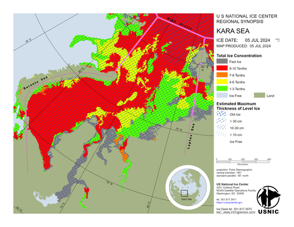
Kara Sea
As the pack ice in the Kara Sea continues to deteriorate, polynyas continue to form and remain, especially in the northern region. Areas of fast ice remain along the mainland coast of Russia and Severnaya Zemlya.
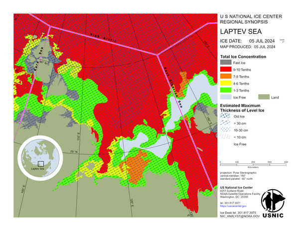
Laptev Sea
Polynyas continue to widen along coastline as river runoff breaks up fast ice in delta regions; Severnaya Zemlya continues to see larger areas of open water and fast ice breakup. First year ice remains steady with minimal drift across the Laptev Sea.
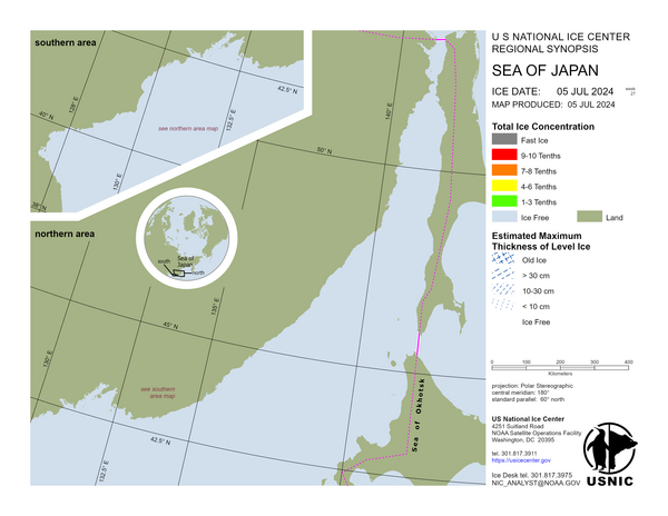
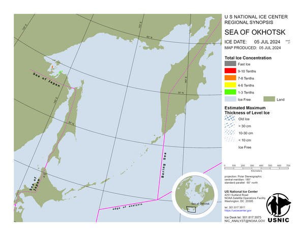
Sea of Okhotsk
Remnant rotten first year ice remains around the southern Shantar Islands.